by SPC Forecast Products | Nov 12, 2024 | Weather and Emergency Alerts
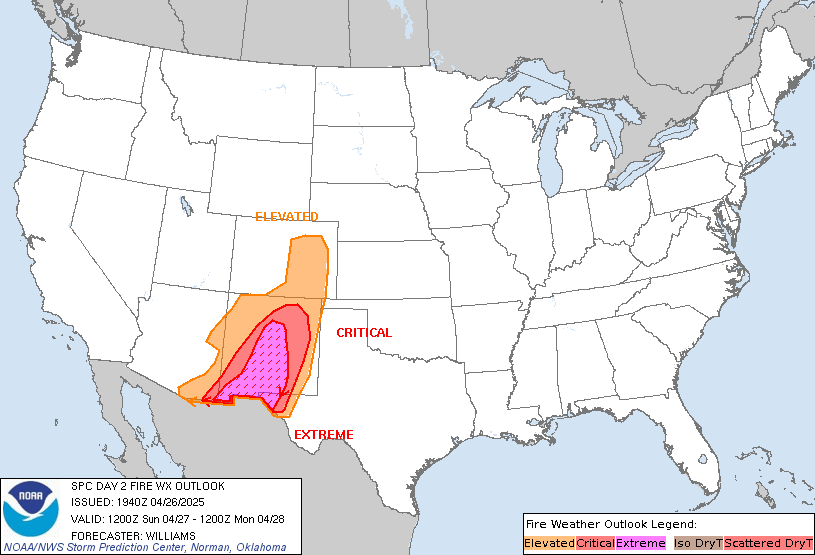
SPC Day 2 Fire Weather Outlook

Day 2 Fire Weather Outlook
NWS Storm Prediction Center Norman OK
0100 PM CST Tue Nov 12 2024

Valid 131200Z - 141200Z

The Elevated area was expanded slightly based on the latest
high-resolution forecast guidance and current dry/windy conditions.
Elsewhere, locally elevated conditions are possible in portions in
southwest Texas and along the Sierra Front. Locally elevated
conditions are also possible in the Appalachians from
Tennessee-North Carolina border through the West Virginia-Virginia
border as southeast winds strengthen with some downslope enhancement
ahead of precipitation Wednesday night.

..Nauslar.. 11/12/2024

.PREV DISCUSSION... /ISSUED 0200 AM CST Tue Nov 12 2024/

...Synopsis...
Gusty post-frontal off-shore flow will continue across portions of
the Northeast from far eastern PA and southern NJ extending
northeast through southern New England. A very dry air mass will
remain in place with relative humidity reductions to around 30-35
percent likely. Given the drought conditions and receptive fuels in
this region, an Elevated delineation was maintained with this
outlook. Locally Critical conditions may be possible, though the
limited spatial extent of this threat precludes the need to include
a Critical area at this time.

...Please see www.spc.noaa.gov/fire for graphic product...
Read more

by SPC Forecast Products | Nov 12, 2024 | Weather and Emergency Alerts
SPC 1730Z Day 2 Outlook

Day 2 Convective Outlook
NWS Storm Prediction Center Norman OK
1115 AM CST Tue Nov 12 2024

Valid 131200Z - 141200Z

...THERE IS A MARGINAL RISK OF SEVERE THUNDERSTORMS ACROSS THE LOWER
MISSISSIPPI VALLEY/CENTRAL GULF COAST REGION...AND COASTAL PORTIONS
OF PACIFIC NORTHWEST...

...SUMMARY...
A marginal tornado/wind threat is apparent on Wednesday afternoon
into Wednesday night across a part of the central Gulf Coast States.
Thunderstorms with strong to locally severe gusts are also possible
near the immediate coasts of Washington, Oregon, and northern
California.

...Synopsis...
A shortwave trough is forecast to move from the Plains through the
MS Valley on Wednesday, becoming more negatively tilted as it does.
An occluded surface low associated with this system will begin the
period over the mid MO Valley before moving eastward across IA and
reaching the northern IL early Thursday morning. More consequently
for the severe-weather potential, a secondary triple-point low is
expected to progress eastward across the northern portion of the
Southeast states, along the northern edge of an eastward-evolving
warm sector. Cold front associated with this low will gradually move
eastward across the Southeast states during the day.

Farther west, an upper-level trough is forecast to progress farther
inland across the western CONUS, as an embedded shortwave trough
moves across northern CA into the interior Northwest/northern Great
Basin.

...Lower Mississippi Valley/Central Gulf Coast...
General expectation is for a triple-point surface low to evolve over
the Mid-South vicinity through the early afternoon as low-level
moisture continues to advect northward across the central Gulf Coast
region. Dewpoints in the upper 60s/low 70s are anticipated ahead of
this low and associated cold front. The airmass is expected to
destabilize amid this low-level moisture, but overall buoyancy will
still be modest given the lack of steep lapse rates. The combination
of destabilization and increasing ascent is forecast to result in
thunderstorm development across the warm sector, but along and ahead
of the eastward-progressing cold front.

The stronger shear will likely be displaced north of the stronger
buoyancy, but enough shear is expected across the warm sector to
support organized storms if updrafts can persist and deepen. This
evolution could support a few marginal supercells and/or stronger
clusters during the afternoon and evening, with a threat of locally
damaging winds and possibly a tornado or two.

Elevated storms will also be possible through the day/evening to the
north of the richer surface moisture. While effective shear will be
sufficient for a few strong elevated storms, the severe potential
with northward extent will tend to be limited by weak midlevel lapse
rates and generally marginal buoyancy.

...WA/OR/Northern CA coasts...
Cold mid-level temperatures (i.e. -24 to -28 deg C at 500 mb)
associated with the upper trough are expected to spread eastward
throughout the day. These cold mid-level temperatures and associated
steep mid-level lapse rates will contribute to modest buoyancy along
the coastal portions of the Pacific Northwest. Highest storm
coverage is anticipated over the northern CA coast vicinity from the
late morning into the early afternoon along as the frontal band
moves through, but persistent forcing for ascent within this
modestly buoyant airmass is expected to result in more cellular
storms throughout the remainder of the afternoon and evening. A more
linear mode is anticipated within the frontal band, with a few
convectively enhanced gusts possible. Low-topped cellular activity
is anticipated in the wake of the frontal band, with a few instances
of small hail, and potentially even a brief tornado, possible.

..Mosier.. 11/12/2024
Read more

by k9oh | Apr 15, 2019 | Weather and Emergency Alerts
This is an automatic message WUUS52 KGSP 150312
SVRGSP
NCC045-071-109-SCC021-091-150400-
/O.NEW.KGSP.SV.W.0024.190415T0312Z-190415T0400Z/
BULLETIN – IMMEDIATE BROADCAST REQUESTED
Severe Thunderstorm Warning
National Weather Service Greenville-Spartanburg SC
1112 PM EDT Sun Apr 14 2019
The National Weather Service in Greenville-Spartanburg has issued a
* Severe Thunderstorm Warning for…
Eastern Lincoln County in the Piedmont of North Carolina…
Southeastern Cleveland County in the Piedmont of North Carolina…
Gaston County in the Piedmont of North Carolina…
Northwestern York County in Upstate South Carolina…
Northeastern Cherokee County in Upstate South Carolina…
* Until midnight EDT.
* At 1112 PM EDT, severe thunderstorms were located along a line
extending from near Shelby to 19 miles west of Gastonia to 6 miles
east of Gaffney, moving east at 35 mph.
HAZARD…60 mph wind gusts.
SOURCE…Radar indicated.
IMPACT…Expect damage to trees and power lines.
* Locations impacted include…
Gastonia, Shelby, Kings Mountain, Mt Holly, Belmont, Cherryville,
Bessemer City, South Gastonia, Clover and Dallas.
PRECAUTIONARY/PREPAREDNESS ACTIONS…
Scattered trees and power lines will be blown down in the warned
area. Seek shelter inside an interior room.
These storms are also producing extremely heavy rainfall. Flooding of
drainage ditches and low lying areas may occur. Small streams will
rise rapidly. Do not drive through areas where water is flowing over
the road.
Please report damaging winds, hail, or flooding to the National
Weather Service Greenville-Spartanburg by calling toll free, 1, 800,
2 6 7, 8 1 0 1, or by posting on our Facebook page, or Tweet it using
hashtag nwsgsp. Your message should describe the event and the
specific location where it occurred.
&&
A Tornado Watch remains in effect until 500 AM EDT for the Piedmont
of North Carolina…and Upstate South Carolina.
LAT…LON 3535 8097 3530 8100 3527 8102 3517 8100
3515 8101 3514 8105 3510 8103 3509 8106
3495 8165 3515 8157 3530 8163 3555 8106
3555 8096 3550 8096 3549 8095 3545 8094
3543 8096 3539 8095 3537 8099 3536 8092
TIME…MOT…LOC 0312Z 248DEG 32KT 3526 8153 3518 8150 3504 8155
TORNADO…POSSIBLE
HAIL…<.75IN
WIND...60MPH
$$
HG


by k9oh | Apr 15, 2019 | Weather and Emergency Alerts
This is an automatic message WUUS52 KGSP 150215
SVRGSP
SCC045-059-083-150300-
/O.NEW.KGSP.SV.W.0022.190415T0215Z-190415T0300Z/
BULLETIN – IMMEDIATE BROADCAST REQUESTED
Severe Thunderstorm Warning
National Weather Service Greenville-Spartanburg SC
1015 PM EDT Sun Apr 14 2019
The National Weather Service in Greenville-Spartanburg has issued a
* Severe Thunderstorm Warning for…
Northwestern Laurens County in Upstate South Carolina…
East central Greenville County in Upstate South Carolina…
Central Spartanburg County in Upstate South Carolina…
* Until 1100 PM EDT.
* At 1015 PM EDT, a severe thunderstorm was located 14 miles
southeast of Greenville Downtown, or 4 miles southeast of Five
Forks, moving east at 40 mph.
HAZARD…60 mph wind gusts.
SOURCE…Radar indicated.
IMPACT…Expect damage to trees and power lines.
* Locations impacted include…
Spartanburg, Simpsonville, Five Forks, Fountain Inn, Woodruff,
Pacolet, Cowpens, Roebuck, Pacolet Mills and Reidville.
PRECAUTIONARY/PREPAREDNESS ACTIONS…
Scattered trees and power lines will be blown down in the warned
area. Seek shelter inside an interior room.
This storm is also producing extremely heavy rainfall. Flooding of
drainage ditches and low lying areas may occur. Small streams will
rise rapidly. Do not drive through areas where water is flowing over
the road.
Please report damaging winds, hail, or flooding to the National
Weather Service Greenville-Spartanburg by calling toll free, 1, 800,
2 6 7, 8 1 0 1, or by posting on our Facebook page, or Tweet it using
hashtag nwsgsp. Your message should describe the event and the
specific location where it occurred.
&&
A Tornado Watch remains in effect until 500 AM EDT for Upstate South
Carolina.
LAT…LON 3463 8224 3482 8228 3503 8180 3499 8177
3493 8176 3493 8174 3491 8172 3483 8179
3461 8185
TIME…MOT…LOC 0215Z 250DEG 35KT 3476 8216
TORNADO…POSSIBLE
HAIL…<.75IN
WIND...60MPH
$$
HG


by k9oh | Apr 15, 2019 | Weather and Emergency Alerts
This is an automatic message WFUS52 KGSP 150116
TORGSP
SCC007-150145-
/O.NEW.KGSP.TO.W.0010.190415T0116Z-190415T0145Z/
BULLETIN – EAS ACTIVATION REQUESTED
Tornado Warning
National Weather Service Greenville-Spartanburg SC
916 PM EDT Sun Apr 14 2019
The National Weather Service in Greenville-Spartanburg has issued a
* Tornado Warning for…
Central Anderson County in Upstate South Carolina…
* Until 945 PM EDT.
* At 916 PM EDT, a severe thunderstorm capable of producing a tornado
was located 10 miles southwest of Anderson, or near Lake Hartwell,
moving northeast at 35 mph.
HAZARD…Tornado.
SOURCE…Radar indicated rotation.
IMPACT…Flying debris will be dangerous to those caught without
shelter. Mobile homes will be damaged or destroyed.
Damage to roofs, windows, and vehicles will occur. Tree
damage is likely.
* This dangerous storm will be near…
Anderson, Northlake, Anderson Airport and Homeland Park around 930
PM EDT.
Belton around 940 PM EDT.
Other locations impacted by this dangerous thunderstorm include Sandy
Springs, Sadlers Creek State Park and Broadway Lake.
PRECAUTIONARY/PREPAREDNESS ACTIONS…
TAKE COVER NOW! Move to a basement or an interior room on the lowest
floor of a sturdy building. Avoid windows. If you are outdoors, in a
mobile home, or in a vehicle, move to the closest substantial shelter
and protect yourself from flying debris.
Tornadoes are extremely difficult to see and confirm at night. Do not
wait to see or hear the tornado. TAKE COVER NOW!
Please report damaging winds, hail, or flooding to the National
Weather Service Greenville-Spartanburg by calling toll free, 1, 800,
2 6 7, 8 1 0 1, or by posting on our Facebook page, or Tweet it using
hashtag nwsgsp. Your message should describe the event and the
specific location where it occurred.
&&
LAT…LON 3437 8284 3444 8286 3447 8287 3449 8291
3448 8292 3449 8293 3475 8252 3467 8246
3462 8245 3459 8242 3456 8242 3454 8239
3451 8237 3435 8281
TIME…MOT…LOC 0116Z 238DEG 31KT 3446 8281
TORNADO…RADAR INDICATED
HAIL…<.75IN
$$
HG


by k9oh | Apr 15, 2019 | Weather and Emergency Alerts
This is an automatic message WFUS52 KGSP 150041
TORGSP
NCC089-175-SCC045-077-150115-
/O.NEW.KGSP.TO.W.0009.190415T0041Z-190415T0115Z/
BULLETIN – EAS ACTIVATION REQUESTED
Tornado Warning
National Weather Service Greenville-Spartanburg SC
841 PM EDT Sun Apr 14 2019
The National Weather Service in Greenville-Spartanburg has issued a
* Tornado Warning for…
Southeastern Transylvania County in western North Carolina…
South central Henderson County in western North Carolina…
Northwestern Greenville County in Upstate South Carolina…
Northwestern Pickens County in Upstate South Carolina…
* Until 915 PM EDT.
* At 841 PM EDT, a severe thunderstorm capable of producing a tornado
was located 11 miles northwest of Pickens, or 5 miles northeast of
Jocassee Gorges, moving northeast at 40 mph.
HAZARD…Tornado.
SOURCE…Radar indicated rotation.
IMPACT…Flying debris will be dangerous to those caught without
shelter. Mobile homes will be damaged or destroyed.
Damage to roofs, windows, and vehicles will occur. Tree
damage is likely.
* This dangerous storm will be near…
Table Rock State Park around 850 PM EDT.
Caesars Head State Park and Dupont State Forest around 900 PM EDT.
Jones Gap State Park and Pleasant Ridge State Park around 910 PM
EDT.
Other locations impacted by this dangerous thunderstorm include
Sunset, Pumpkintown, Little River In Transylvania County, Connestee
and Crab Creek.
PRECAUTIONARY/PREPAREDNESS ACTIONS…
TAKE COVER NOW! Move to a basement or an interior room on the lowest
floor of a sturdy building. Avoid windows. If you are outdoors, in a
mobile home, or in a vehicle, move to the closest substantial shelter
and protect yourself from flying debris.
Tornadoes are extremely difficult to see and confirm at night. Do not
wait to see or hear the tornado. TAKE COVER NOW!
Please report damaging winds, hail, or flooding to the National
Weather Service Greenville-Spartanburg by calling toll free, 1, 800,
2 6 7, 8 1 0 1, or by posting on our Facebook page, or Tweet it using
hashtag nwsgsp. Your message should describe the event and the
specific location where it occurred.
&&
LAT…LON 3532 8258 3509 8239 3489 8283 3501 8293
3501 8291 3502 8292 3503 8292 3505 8290
3504 8296
TIME…MOT…LOC 0041Z 237DEG 35KT 3502 8281
TORNADO…RADAR INDICATED
HAIL…<.75IN
$$
HG


