Flood Warning issued November 13 at 11:21AM EST until November 14 at 7:00AM EST by NWS Charleston SC
* WHAT...Flooding is occurring along the Edisto River between Canadys and Branchville. * WHERE...Portions of Colleton and Dorchester counties. * WHEN...Until 700 AM EST Thursday. * IMPACTS...Flooding of homes, low-lying roads, and river access points. * ADDITIONAL DETAILS... - At 1120 AM EST, Emergency management reported ongoing flooding across the warned area, especially between Branchville and Canadys.Flood Warning issued November 13 at 11:20AM EST until November 14 at 4:00PM EST by NWS Charleston SC
* WHAT...Minor flooding is occurring and minor flooding is forecast. * WHERE...Savannah River near Clyo. * WHEN...Until Thursday afternoon. * IMPACTS...At 11.0 feet, the back yards of several homes on Tom Goethe Road flood. * ADDITIONAL DETAILS... - At 1015 AM EST Wednesday, the stage was 11.4 feet. - Forecast...The river is expected to fall below flood stage early Thursday morning and continue falling to 8.4 feet Monday morning. - Flood stage is 11.0 feet.Flood Warning issued November 13 at 11:20AM EST by NWS Charleston SC
* WHAT...Moderate flooding is occurring and moderate flooding is forecast. * WHERE...Edisto River near Givhans Ferry. * WHEN...Until further notice. * IMPACTS...At 14.2 feet, numerous homes along Happiness Lane are flooded. Water covers most of Hideaway Lane. * ADDITIONAL DETAILS... - At 1030 AM EST Wednesday, the stage was 14.6 feet. - Forecast...The river is expected to fall to 10.8 feet Monday morning. - Flood stage is 10.0 feet.Flood Warning issued November 13 at 5:53AM EST until November 14 at 7:00PM EST by NWS Columbia SC
* WHAT...Small stream flooding caused by excessive rainfall continues. * WHERE...A portion of central South Carolina, including the following counties, Bamberg and Orangeburg. * WHEN...Until 700 PM EST Thursday. * IMPACTS...Emergency management reported flooding in the warned area from recent heavy rain. Water continues to slowly recede on the South Fork of the Edisto River but will remain high, especially near Branchville over the next couple of days. * ADDITIONAL DETAILS... - At 551 AM EST, emergency management reported ongoing flooding across the warned area. - Flooding impacts will continue, but no additional rainfall is expected. - Some locations that will experience flooding include... mainly rural areas of Northeastern Bamberg and South Central Orangeburg Counties - http://www.weather.gov/safety/flood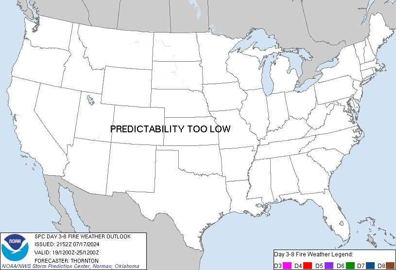
SPC Day 3-8 Fire Weather Outlook
SPC Day 3-8 Fire Weather Outlook
Day 3-8 Fire Weather Outlook
NWS Storm Prediction Center Norman OK
0335 PM CST Tue Nov 12 2024

Valid 141200Z - 201200Z

Upper-level troughing is expected over both the East and West Coasts
Day 3/Thursday - Day 5/Saturday, with upper-level ridging slowly
shifting from over the central US to over portions of the eastern
US. There is forecast uncertainty regarding how this amplified
upper-level pattern progresses early next week, which will have
ramifications for potential fire weather concerns in
southern/central California and the Northeast.

...Northeast and Mid-Atlantic...
An approaching warm front with associated cloud cover and possible
shower activity will limit fire weather concerns across the
Mid-Atlantic and into portions of the Northeast on Day 3/Thursday.
However, dry/breezy conditions are likely to develop across portions
of the Mid-Atlantic and Northeast Day 4/Friday - Day 6/Saturday.
Given the recent drought, lack of forecast rain, and near to record
high fire danger, 40% probabilities were expanded and introduced
during what appears to be a multi-day fire weather episode. Some
forecast uncertainty remains regarding forecast precipitation and
where the greatest overlap of elevated/critical winds/RH will be,
but confidence is increasing in at least elevated fire weather
conditions for portions of New Jersey, eastern Pennsylvania, the
Hudson Valley/vicinity, and southern New England late this week
through the weekend.

...Southern/central California...
Breezy/gusty north-northwest winds are possible in portions of
central/southern California Day 5/Saturday into Day 7/Monday as
multiple cold fronts sweep south and east over the region. The
southern extent of forecast precipitation and the magnitude of these
winds remain uncertain precluding 40% areas at this time. Confidence
is increasing in an offshore/Santa Ana wind event mid-next week,
which is on the edge of the outlook period. This event may start on
Day 8/Tuesday and last multiple days. This will be monitored and if
trends hold, probabilities will likely be added in subsequent
extended outlooks.

..Nauslar.. 11/12/2024

...Please see www.spc.noaa.gov/fire for graphic product...
Read more

SPC Day 3-8 Fire Weather Outlook
SPC Day 3-8 Fire Weather Outlook
Day 3-8 Fire Weather Outlook
NWS Storm Prediction Center Norman OK
0335 PM CST Tue Nov 12 2024

Valid 141200Z - 201200Z

Upper-level troughing is expected over both the East and West Coasts
Day 3/Thursday - Day 5/Saturday, with upper-level ridging slowly
shifting from over the central US to over portions of the eastern
US. There is forecast uncertainty regarding how this amplified
upper-level pattern progresses early next week, which will have
ramifications for potential fire weather concerns in
southern/central California and the Northeast.

...Northeast and Mid-Atlantic...
An approaching warm front with associated cloud cover and possible
shower activity will limit fire weather concerns across the
Mid-Atlantic and into portions of the Northeast on Day 3/Thursday.
However, dry/breezy conditions are likely to develop across portions
of the Mid-Atlantic and Northeast Day 4/Friday - Day 6/Saturday.
Given the recent drought, lack of forecast rain, and near to record
high fire danger, 40% probabilities were expanded and introduced
during what appears to be a multi-day fire weather episode. Some
forecast uncertainty remains regarding forecast precipitation and
where the greatest overlap of elevated/critical winds/RH will be,
but confidence is increasing in at least elevated fire weather
conditions for portions of New Jersey, eastern Pennsylvania, the
Hudson Valley/vicinity, and southern New England late this week
through the weekend.

...Southern/central California...
Breezy/gusty north-northwest winds are possible in portions of
central/southern California Day 5/Saturday into Day 7/Monday as
multiple cold fronts sweep south and east over the region. The
southern extent of forecast precipitation and the magnitude of these
winds remain uncertain precluding 40% areas at this time. Confidence
is increasing in an offshore/Santa Ana wind event mid-next week,
which is on the edge of the outlook period. This event may start on
Day 8/Tuesday and last multiple days. This will be monitored and if
trends hold, probabilities will likely be added in subsequent
extended outlooks.

..Nauslar.. 11/12/2024

...Please see www.spc.noaa.gov/fire for graphic product...
Read more
SPC – No watches are valid as of Tue Nov 12 21:42:01 UTC 2024
No watches are valid as of Tue Nov 12 21:42:01 UTC 2024.SPC – No MDs are in effect as of Tue Nov 12 21:42:01 UTC 2024
No Mesoscale Discussions are in effect as of Tue Nov 12 21:42:01 UTC 2024.
SPC Nov 12, 2024 2000 UTC Day 1 Convective Outlook
SPC 2000Z Day 1 Outlook
Day 1 Convective Outlook
NWS Storm Prediction Center Norman OK
0158 PM CST Tue Nov 12 2024

Valid 122000Z - 131200Z

...THERE IS A MARGINAL RISK OF SEVERE THUNDERSTORMS FOR PORTIONS OF
THE SOUTHERN HIGH PLAINS...

...SUMMARY...
Isolated strong to severe thunderstorms may impact parts of the
Texas South Plains and Oklahoma/Texas Panhandle vicinity into far
southwestern Kansas this evening, possibly accompanied by some risk
for hail and gusty winds.

...20Z Update...
The primary change to this outlook was to expand Marginal Risk
probabilities northward into portions of far southwestern KS. Here,
guidance consensus depicts 700-1000 J/kg MUCAPE amid elongated
hodographs, which may support an instance or two of marginally
severe hail with the more persistent, discrete updrafts that can
form. Otherwise, the previous forecast (see below) remains on track.

..Squitieri.. 11/12/2024

.PREV DISCUSSION... /ISSUED 1024 AM CST Tue Nov 12 2024/

...Southern High Plains...
An upper-level trough over the eastern Great Basin/Four Corners at
midday will continue eastward toward the south-central High Plains
tonight. Gradual lee-side cyclogenesis will occur particularly late
today into tonight, with a sharpening southern High Plains
dryline/lee trough, with an eastward-moving Pacific cold front that
will overtake the dryline/lee trough from west-to-east tonight.
Modest-caliber low-level moisture return will occur
north-northwestward across the southern High Plains, with surface
dewpoints tending to remain limited to the upper 40s/lower 50s F
into this evening.

It still appears likely that deep convective potential across
northwest Texas and the Oklahoma/Texas Panhandles will remain
limited through peak heating, owing to the moisture limitations and
a persistent capping inversion. Isolated thunderstorm development
will become more probable after sunset as lift associated with a
strengthening low-level jet increases, and as the surface cold front
overtakes the lee trough.

While MUCAPE is expected to remain rather weak (generally 500-1000
J/kg or less), strong deep-layer shear will support organized
updrafts with any sustained convection. Isolated hail appears to be
the main threat, as thunderstorms should have a tendency to remain
slightly elevated. But, some chance for strong/gusty winds may also
exist. The window for severe hail should remain small in space and
time this evening, as convection will likely grow upscale fairly
quickly. Even so, small hail may occur farther north/east into parts
of Kansas and Oklahoma overnight into early Wednesday morning.
Read more

SPC Nov 12, 2024 1930 UTC Day 3 Severe Thunderstorm Outlook
SPC 1930Z Day 3 Outlook
Day 3 Convective Outlook
NWS Storm Prediction Center Norman OK
0113 PM CST Tue Nov 12 2024

Valid 141200Z - 151200Z

...NO SEVERE THUNDERSTORM AREAS FORECAST...

...SUMMARY...
Organized severe thunderstorms are not currently expected on
Thursday.

...Synopsis...
A negatively titled shortwave trough is forecast to extend from the
Upper Midwest into the southern Appalachians early Thursday morning.
This trough is expected to lose amplitude as it continues eastward
while also developing a closed mid-level circulation. This resulting
cyclone will then likely progress across the Upper OH Valley and
into the Mid-Atlantic by early Friday. In response to this
evolution, surface cyclogenesis is anticipated off the Carolina
coast, or perhaps just inland over the coastal Carolinas.

Farther west, the overall upper pattern will amplify as ridging
builds across the Plains and troughing deepens along the West Coast.

...Central/Northeast Gulf Coast vicinity...
Showers and thunderstorms will likely be ongoing over the central
Gulf Coast early Thursday morning, as a cold front pushes eastward
through moist and modestly buoyant warm sector in place across the
region. Northern extent of this warm sector is expected to become
increasingly confined throughout the day with the cooler, more
continental airmass over the Carolinas and Mid-Atlantic remaining
place. A strong storm or two is possible within this warm sector,
particularly Thursday morning from southwest/southern AL into the
western FL Panhandle, but limited buoyancy and weakening shear
should keep any severe threat isolated, precluding the need for any
severe probabilities with this outlook.

...Coastal Carolinas...
Uncertainty regarding the strength and location of the surface low
expected to deepen over the region late Thursday night/early Friday
morning limits the confidence on how far inland any favorable
low-level moisture/buoyancy would penetrate. Current guidance
suggests there could be a confined area along the warm front near
the northern NC Coast where there is enough overlap between modest
buoyancy and strong shear to support some severe potential. Given
the limited spatial extent of this region and the general
uncertainty regarding the overall pattern, no severe probabilities
were introduced with this outlook. However, a small area maybe
needed in future outlooks if forecast confidence increases.

..Mosier.. 11/12/2024
Read more
SPC Day 2 Fire Weather Outlook
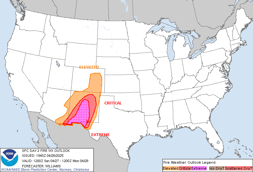
SPC Day 2 Fire Weather Outlook
Day 2 Fire Weather Outlook
NWS Storm Prediction Center Norman OK
0100 PM CST Tue Nov 12 2024

Valid 131200Z - 141200Z

The Elevated area was expanded slightly based on the latest
high-resolution forecast guidance and current dry/windy conditions.
Elsewhere, locally elevated conditions are possible in portions in
southwest Texas and along the Sierra Front. Locally elevated
conditions are also possible in the Appalachians from
Tennessee-North Carolina border through the West Virginia-Virginia
border as southeast winds strengthen with some downslope enhancement
ahead of precipitation Wednesday night.

..Nauslar.. 11/12/2024

.PREV DISCUSSION... /ISSUED 0200 AM CST Tue Nov 12 2024/

...Synopsis...
Gusty post-frontal off-shore flow will continue across portions of
the Northeast from far eastern PA and southern NJ extending
northeast through southern New England. A very dry air mass will
remain in place with relative humidity reductions to around 30-35
percent likely. Given the drought conditions and receptive fuels in
this region, an Elevated delineation was maintained with this
outlook. Locally Critical conditions may be possible, though the
limited spatial extent of this threat precludes the need to include
a Critical area at this time.

...Please see www.spc.noaa.gov/fire for graphic product...
Read more

SPC Day 2 Fire Weather Outlook
SPC Day 2 Fire Weather Outlook
Day 2 Fire Weather Outlook
NWS Storm Prediction Center Norman OK
0100 PM CST Tue Nov 12 2024

Valid 131200Z - 141200Z

The Elevated area was expanded slightly based on the latest
high-resolution forecast guidance and current dry/windy conditions.
Elsewhere, locally elevated conditions are possible in portions in
southwest Texas and along the Sierra Front. Locally elevated
conditions are also possible in the Appalachians from
Tennessee-North Carolina border through the West Virginia-Virginia
border as southeast winds strengthen with some downslope enhancement
ahead of precipitation Wednesday night.

..Nauslar.. 11/12/2024

.PREV DISCUSSION... /ISSUED 0200 AM CST Tue Nov 12 2024/

...Synopsis...
Gusty post-frontal off-shore flow will continue across portions of
the Northeast from far eastern PA and southern NJ extending
northeast through southern New England. A very dry air mass will
remain in place with relative humidity reductions to around 30-35
percent likely. Given the drought conditions and receptive fuels in
this region, an Elevated delineation was maintained with this
outlook. Locally Critical conditions may be possible, though the
limited spatial extent of this threat precludes the need to include
a Critical area at this time.

...Please see www.spc.noaa.gov/fire for graphic product...
Read more

SPC Nov 12, 2024 1730 UTC Day 2 Convective Outlook
SPC 1730Z Day 2 Outlook
Day 2 Convective Outlook
NWS Storm Prediction Center Norman OK
1115 AM CST Tue Nov 12 2024

Valid 131200Z - 141200Z

...THERE IS A MARGINAL RISK OF SEVERE THUNDERSTORMS ACROSS THE LOWER
MISSISSIPPI VALLEY/CENTRAL GULF COAST REGION...AND COASTAL PORTIONS
OF PACIFIC NORTHWEST...

...SUMMARY...
A marginal tornado/wind threat is apparent on Wednesday afternoon
into Wednesday night across a part of the central Gulf Coast States.
Thunderstorms with strong to locally severe gusts are also possible
near the immediate coasts of Washington, Oregon, and northern
California.

...Synopsis...
A shortwave trough is forecast to move from the Plains through the
MS Valley on Wednesday, becoming more negatively tilted as it does.
An occluded surface low associated with this system will begin the
period over the mid MO Valley before moving eastward across IA and
reaching the northern IL early Thursday morning. More consequently
for the severe-weather potential, a secondary triple-point low is
expected to progress eastward across the northern portion of the
Southeast states, along the northern edge of an eastward-evolving
warm sector. Cold front associated with this low will gradually move
eastward across the Southeast states during the day.

Farther west, an upper-level trough is forecast to progress farther
inland across the western CONUS, as an embedded shortwave trough
moves across northern CA into the interior Northwest/northern Great
Basin.

...Lower Mississippi Valley/Central Gulf Coast...
General expectation is for a triple-point surface low to evolve over
the Mid-South vicinity through the early afternoon as low-level
moisture continues to advect northward across the central Gulf Coast
region. Dewpoints in the upper 60s/low 70s are anticipated ahead of
this low and associated cold front. The airmass is expected to
destabilize amid this low-level moisture, but overall buoyancy will
still be modest given the lack of steep lapse rates. The combination
of destabilization and increasing ascent is forecast to result in
thunderstorm development across the warm sector, but along and ahead
of the eastward-progressing cold front.

The stronger shear will likely be displaced north of the stronger
buoyancy, but enough shear is expected across the warm sector to
support organized storms if updrafts can persist and deepen. This
evolution could support a few marginal supercells and/or stronger
clusters during the afternoon and evening, with a threat of locally
damaging winds and possibly a tornado or two.

Elevated storms will also be possible through the day/evening to the
north of the richer surface moisture. While effective shear will be
sufficient for a few strong elevated storms, the severe potential
with northward extent will tend to be limited by weak midlevel lapse
rates and generally marginal buoyancy.

...WA/OR/Northern CA coasts...
Cold mid-level temperatures (i.e. -24 to -28 deg C at 500 mb)
associated with the upper trough are expected to spread eastward
throughout the day. These cold mid-level temperatures and associated
steep mid-level lapse rates will contribute to modest buoyancy along
the coastal portions of the Pacific Northwest. Highest storm
coverage is anticipated over the northern CA coast vicinity from the
late morning into the early afternoon along as the frontal band
moves through, but persistent forcing for ascent within this
modestly buoyant airmass is expected to result in more cellular
storms throughout the remainder of the afternoon and evening. A more
linear mode is anticipated within the frontal band, with a few
convectively enhanced gusts possible. Low-topped cellular activity
is anticipated in the wake of the frontal band, with a few instances
of small hail, and potentially even a brief tornado, possible.

..Mosier.. 11/12/2024
Read more

Severe Thunderstorm Warning
This is an automatic message WUUS52 KGSP 150312
SVRGSP
NCC045-071-109-SCC021-091-150400-
/O.NEW.KGSP.SV.W.0024.190415T0312Z-190415T0400Z/
BULLETIN – IMMEDIATE BROADCAST REQUESTED
Severe Thunderstorm Warning
National Weather Service Greenville-Spartanburg SC
1112 PM EDT Sun Apr 14 2019
The National Weather Service in Greenville-Spartanburg has issued a
* Severe Thunderstorm Warning for…
Eastern Lincoln County in the Piedmont of North Carolina…
Southeastern Cleveland County in the Piedmont of North Carolina…
Gaston County in the Piedmont of North Carolina…
Northwestern York County in Upstate South Carolina…
Northeastern Cherokee County in Upstate South Carolina…
* Until midnight EDT.
* At 1112 PM EDT, severe thunderstorms were located along a line
extending from near Shelby to 19 miles west of Gastonia to 6 miles
east of Gaffney, moving east at 35 mph.
HAZARD…60 mph wind gusts.
SOURCE…Radar indicated.
IMPACT…Expect damage to trees and power lines.
* Locations impacted include…
Gastonia, Shelby, Kings Mountain, Mt Holly, Belmont, Cherryville,
Bessemer City, South Gastonia, Clover and Dallas.
PRECAUTIONARY/PREPAREDNESS ACTIONS…
Scattered trees and power lines will be blown down in the warned
area. Seek shelter inside an interior room.
These storms are also producing extremely heavy rainfall. Flooding of
drainage ditches and low lying areas may occur. Small streams will
rise rapidly. Do not drive through areas where water is flowing over
the road.
Please report damaging winds, hail, or flooding to the National
Weather Service Greenville-Spartanburg by calling toll free, 1, 800,
2 6 7, 8 1 0 1, or by posting on our Facebook page, or Tweet it using
hashtag nwsgsp. Your message should describe the event and the
specific location where it occurred.
&&
A Tornado Watch remains in effect until 500 AM EDT for the Piedmont
of North Carolina…and Upstate South Carolina.
LAT…LON 3535 8097 3530 8100 3527 8102 3517 8100
3515 8101 3514 8105 3510 8103 3509 8106
3495 8165 3515 8157 3530 8163 3555 8106
3555 8096 3550 8096 3549 8095 3545 8094
3543 8096 3539 8095 3537 8099 3536 8092
TIME…MOT…LOC 0312Z 248DEG 32KT 3526 8153 3518 8150 3504 8155
TORNADO…POSSIBLE
HAIL…<.75IN
WIND...60MPH
$$
HG

